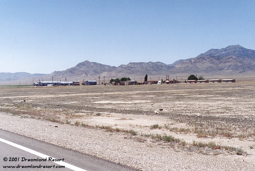
Basecamp, seen from Hwy 6. The gray buildings on the left is the maintenance area, the tan buildings on the right the living quarters. The airstrip goes out of frame to the right of the living quarters. Taken on 6/9/2001.
Basecamp is located about 10 miles NE of Warm Springs, on the west side of Hwy 6. It includes a housing complex, a large service area for vehicles and equipment, a fire station and some radar equipment. And of course a runway, which runs parallel to the highway, in plain sight. According to the "Special Nevada Report", September 23, 1991 below: "Base Camp is used as a staging and support area for field personnel and as a recreation area for military and contractor personnel." According to the same source it is usually manned by 3 to 6 people.
A (public) dirt road, leading from Hwy 6 to the abandoned mining town Tybo in the mountains, goes right through Basecamp. It divides it into the southern maintenance area and the living quarters in the north. You can drive through and take a look around, but better stay on the road. Once you are past the buildings you are at the south end of the airstrip, which leads NE from here. There is a small ramp and a small storage building but no hangars or other larger buildings, and usually no planes either. On one occasion we have seen one of the small Beechcraft 1900 "Janets" (N20RA) sitting parked on the ramp.
Basecamp was first developed as a staging area by the Atomic Energy Commission (AEC), a predecessor of the DOE, during the underground nuclear tests in the area in the late 1960s. In particular for "Project Faultless", an underground thermonuclear detonation with 67 times the energy of the bomb dropped on Hiroshima, Japan. When the test was set off on January 19, 1968 its catastrophic results for the environment led to the immediate cancellation of any further tests.
After being abandoned by the DOE, Basecamp was taken over by the Air Force, which built a modern 7300-foot runway. In fact there is evidence that Basecamp is now owned by the Air Force Flight Test Center (AFFTC) at Edwards Air Force Base. The same department that owns Area 51. There is a heavy duty microwave link to Area 51 via Halligan Mesa (see below) and Bald Mountain. Basecamp also shares the same trunking radio system in use at Area 51 and in other parts of the NTTR.
The runway was extended and improved several times over the years. It was used as test airfield for touch-and-go practice during the development of the F-117 Stealth Fighter at Area 51 and later at TTR. Also, Basecamp is almost in line with the north end of the runways at Groom, which makes it an ideal emergency airfield in case of problems during takeoff of a test flight.
A secret facility so close to the highway, and in plain sight? It makes sense when you consider that Hwy 6 only has very light traffic, especially at night. Also, everything is very casual and low-key, and to a passing traveler the whole place looks pretty deserted. Until you turn onto the dirt road, and pull your vehicle off the road near the airstrip. Within a couple of minutes a security guard in an older model pickup truck will approach you. If you stay near the road you are on public land and perfectly legal to be there. Typically the guard will ask if you need assistance. He has no legal authority to question you about what you are doing there, let alone tell you to leave.
About halfway down the runway you can see the old Basecamp VOR transmitter building. The VOR is no longer active and the large cone shaped antenna at the top has been removed. The VOR frequency was 113.900 MHz. The Morse code ID "AEC" was a reminder of the original use of the camp.
Roughly in line with the runway, about 15 miles NNE on Halligan Mesa, is a related facility. It includes a large radar dome for tracking aircraft in the NTTR and a tower with several large microwave dishes. These dishes provide the microwave link from Basecamp to Area 51.
A second site on a mountain top near Warm Springs about 11 miles SW appears mostly abandoned. The 2001 photo below shows the mobile radar site at that location. This site is linked to Cedar Peak via Ragged Ridge. As of our last visit in 2019 the microwave link was still active but no other equipment was present. The other antennas at that site serve various civilian purposes, such as cell phone, law enforcement, a HAM repeater etc.
Update 08/2020: Click here for new aerial photo of Basecamp, taken on July 30, 2020.
Basecamp, seen from Hwy 6. The gray buildings on the left is the maintenance area, the tan buildings on the right the living quarters. The airstrip goes out of frame to the right of the living quarters. Taken on 6/9/2001.
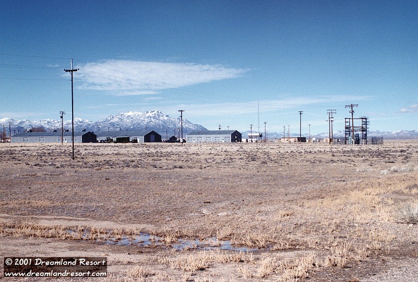
The maintenance buildings and the main transformer station seen from the south. Taken in winter 2000.
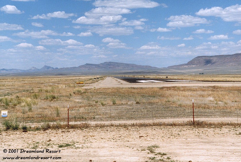
The Basecamp runway, looking NE from the dirt road to Tybo ghost town. Notice the small "No trespassing" sign on the fence. Halligan Mesa with the white radar dome on top can be seen in the background, almost in line with the runway. Taken in spring 1999.
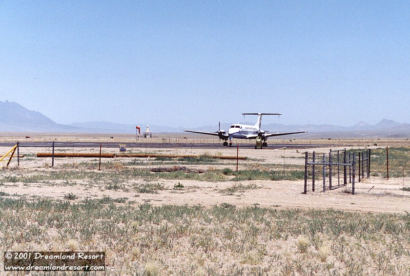
N20RA, one of the Beechcraft executive aircraft that operate from the Las Vegas Janet terminal, sitting on the Basecamp ramp. In the background is the VOR transmitter. Taken on 6/9/2001.
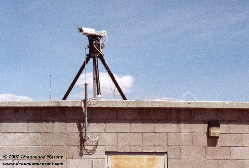
Update: On 4/8/2002 we found four new security cameras near the entrance to the Basecamp airfield. These two are mounted on top of a small building. A similar setup with two more cameras, which did not appear to be hooked up yet, was sitting on the ground next to the building.

The radar dome on Halligan Mesa, about 15 miles NNE of Base Camp. The two large dishes are a microwave relay to Bald Mountain. The smaller dish is a relay to Basecamp. Photo taken 05/13/2019.
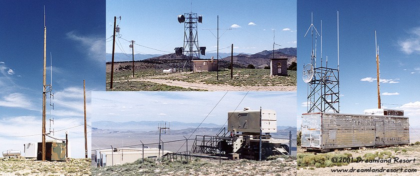
Radio facility on a mountain top near Warm Springs, about 11 miles SW of Base Camp. Taken on 6/9/2001.
Base Camp and Halligan Mesa are withdrawn by the Air Force and occupy approximately 600 acres in Hot Creek Valley in north Central Nye County. Base Camp is located 60 miles east of Tonopah on US 6. A county road passes through Base Camp land. Halligan Mesa is located approximately 15 miles northeast of Base Camp along US Highway 6 and then 3 miles northwest along a dirt road. There are no proposed changes in ownership, mission, boundaries or use of Base Camp and Halligan Mesa through the year 2000.
An electronics and communications facility on Halligan Mesa, and an associated support area at Base Camp, are used for collecting data for Air Force testing programs conducted in the vicinity of the Tonopah Test Range (TTR) and the Nellis North Range. Base Camp is used as a staging and support area for field personnel and as a recreation area for military and contractor personnel. Base Camp has a recently extended and improved airstrip, several buildings for sleeping quarters, shop and maintenance buildings, and a recreation building. Base Camp is manned by three to six people. Halligan Mesa is unmanned and a helicopter pad is located near the facility.