Aerial Photos of Basecamp, July 30, 2020


Images with friendly permission from the photographer. Click in the photos to enlarge.

For more information on Basecamp click here.


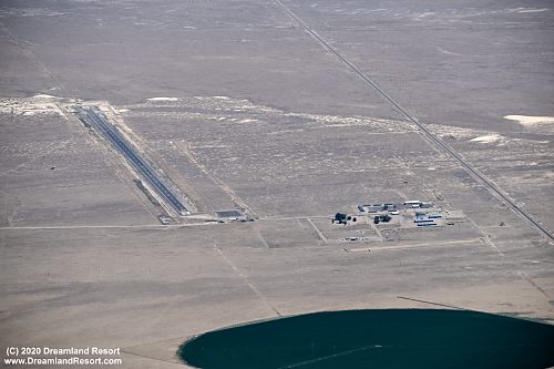
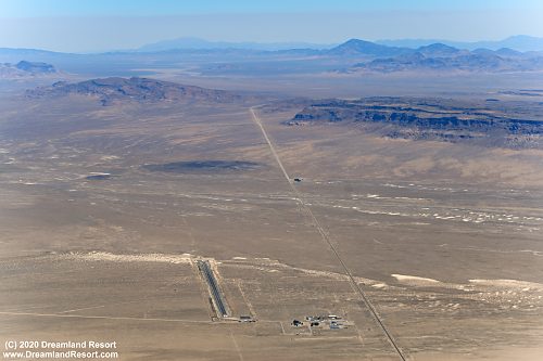
Aerial view of Basecamp at the bottom of the picture, looking north-east. US-6 from Tonopah to Ely is clearly visible running right past Basecamp. Halligan Mesa with the radio site on top is visible in the background left.

Closer view of Basecamp. The dirt road leading from Hwy 6 through Basecamp goes to the historic mining town of Tybo. It is a public road.
Close-up of the Basecamp runway with a small ramp at the south end near the road. Notice the runway is freshly paved but marked as abandoned with X-es on both ends. The base of the old VOR is to the left of the runway. The VOR is no longer active and the large cone shaped antenna has been removed.

Close-up of the building complex. The part south of the road to Tybo is mostly shops and storage. The home of the caretaker is also located here surrounded by trees. The northern part is living quarters. In the foreground you can see a below-ground shooting range that is not visible from the road.


© Copyright 1999-, Dreamland Resort. All rights reserved.   Copyright Policy   Privacy Policy   Page last modified 05/22/2024