Station 700 between Area 51 and the NTS
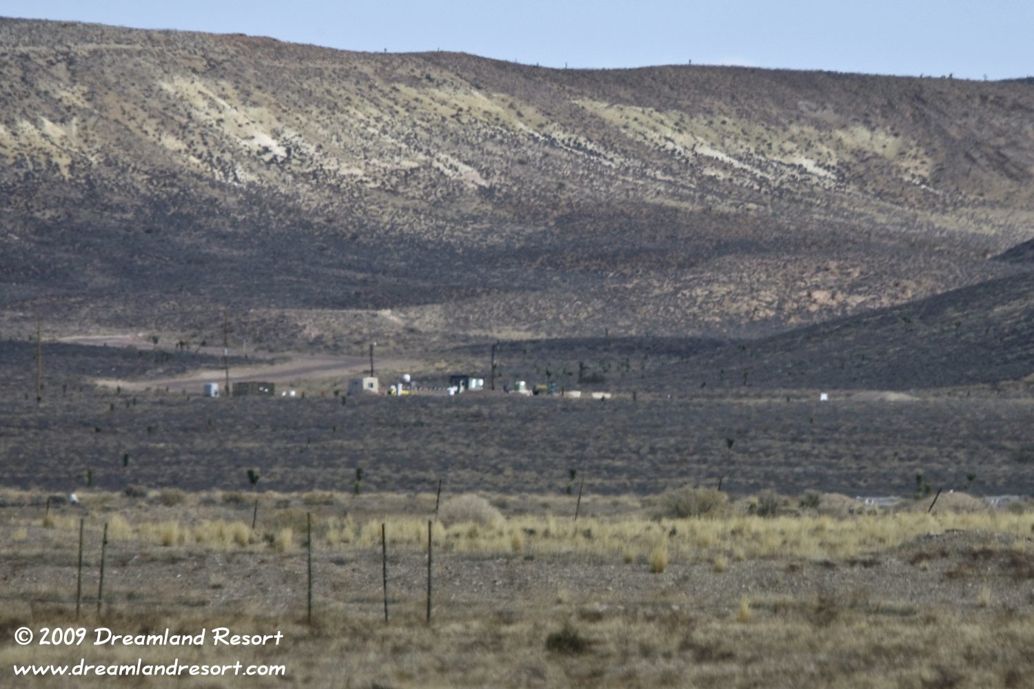
Besides the Groom Lake Road gate and the North Gate near Rachel, Station 700 is the third major gate into Area 51. But, unlike the other two, this gate is not accessible to the public. As internet exclusives, we have obtained the rare photos below, taken in late 2008, from a source who wishes to remain anonymous.
Station 700, sometimes referred to as Gate 700, is located west of Area 51, where it borders on the Nevada National Security Site (NNSS). The NNSS, formerly known as Nevada Test Site (NTS), is strictly off-limits to the public. In the 1950's and 60's, at the height of the Cold War, it was the primary site for nuclear tests. Today the NNSS is used by several contractors and government agencies for projects that for various reasons require a certain amount of "privacy". The only time the public gets near Station 700 is during public NNSS tours. Near the north end of the tour, at Sedan Crater, the guard buildings can be seen in the distance, at the foot of the mountain range that separates Area 51 from the NNSS. Cameras are strictly prohibited on the tour, and the photos below are, to the best of our knowledge, the only publicly available photos of Station 700. However, it can be seen on Google Earth. The coordinates are 37°11'23"N / 116° 1'10"W.
The shortest route by car from Las Vegas into Area 51 is to take Hwy. 95 north, enter the NNSS at Mercury, head up Mercury Highway and then take Groom Lake Road to enter Area 51 at Station 700. Many contractors take this route, as well as construction traffic, deliveries etc. An additional advantage of using Station 700 is that it is impossible for the public to determine how much of the traffic that enters the restricted area at the Mercury checkpoint (Station 100), actually goes into Area 51.
We are told by an anonymous source that at the time the photos below were taken, in late 2008, about 200 trucks daily entered Area 51 that way. Most of them were hauling in concrete construction material. This was likely related to the construction of two large hangars at the south end of the base, labeled 2007 Hangar and 2009 Hangar in our building map. It may also be related to paving many of the roads inside Area 51. Either way it proves that Area 51 still utilizes the well developed infrastructure of the NNSS. Back in 1955 when Area 51 was founded the existence of this infrastructure nearby was a key reason for selecting the site at the south end of Groom Lake.
We would like to thank our anonymous source for allowing us to share the photos with our readers.

| Station 700, seen from a location near Sedan Crater on the NTS. Groom Lake Road enters the gate and leads over the mountain range into Emigrant Valley and to Area 51. Many contractors and delivery trucks from the Las Vegas area take this route into Area 51. |

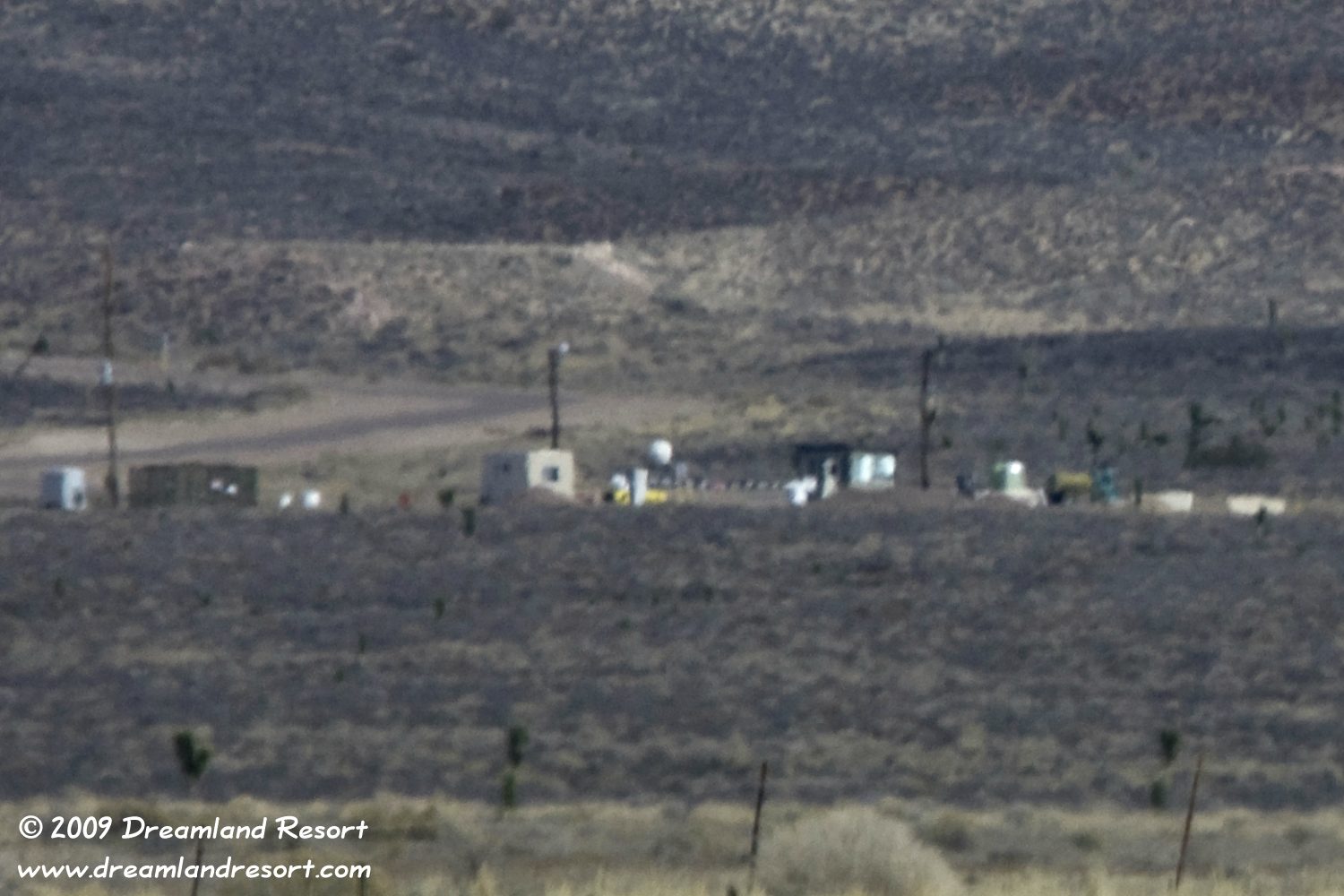
| Close-up of the gate area. The Guard Shack looks very similar to the new guard shack at the North Gate. No indoor plumbing here either, but the familiar poles with lights and probably a security camera. What looks like a white dome could be a microwave transmitter pointed at a reflector or repeater in the hills of Areas 8 or 12 for communication with Groom. |
© Copyright 1999-, Dreamland Resort. All rights reserved. Copyright Policy Privacy Policy Page last modified 11/10/2019

