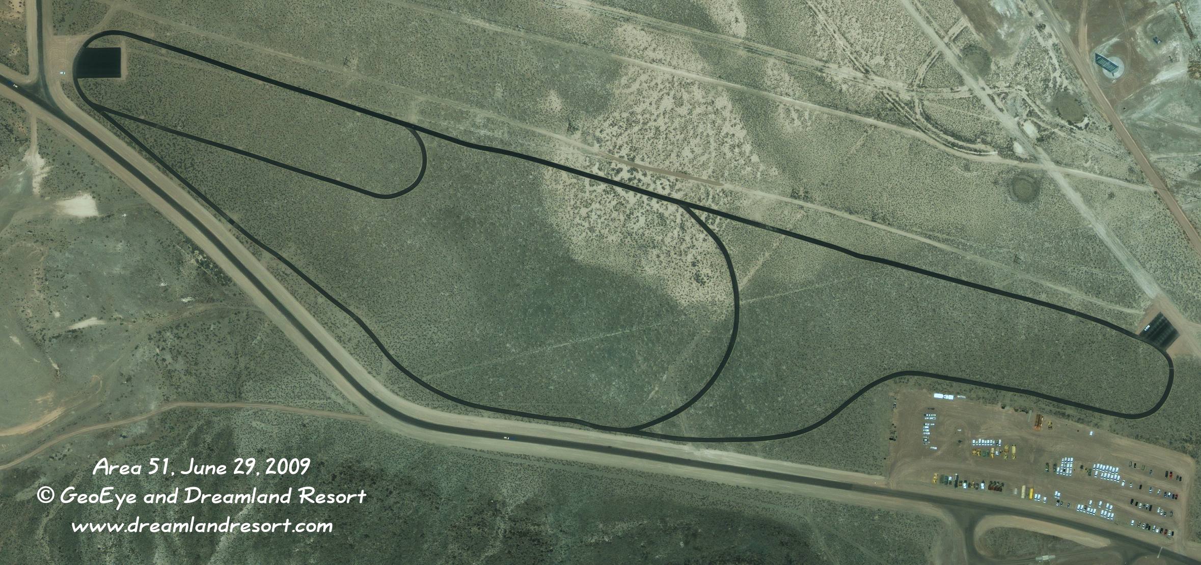
A new racetrack-like structure has been constructed just northwest of the shipping and receiving facility. The three tracks have a length of 0.5, 1.0 and 1.5 miles. The longest straight leg is 0.7 miles long. It appears that the main access to the track is from the pad in the north-west corner. This track is also visible from Tikaboo Peak, in the area behind the two large dishes.
There has been some speculation about the track being used for UAV testing etc., but it appears that, as so often, the truth is much more mundane. Similar tracks have recently been constructed at other bases, including Nellis AFB (Area 2), Creech AFB, Luke AFB, Davis-Monthan AFB and others. They appear to be running tracks for physical training of base personnel.
In this 0.5 meter resolution image you can clearly see cars travelling on Groom Lake Road to and from Gate 700 to the NTS. The road to the north leads to "Slater Lake", a former recreation area, which today houses several radio sites.
Satellite image taken by the GeoEye-1 satellite on Monday, June 29, 2009 at 11.26am PDT. © 2009 GeoEye and Dreamland Resort. Publication outside of the Dreamland Resort web site is strictly prohibited.