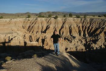
Cathedral Gorge State Park
 Cathedral Gorge State Park |
The first crash site just happened a week ago on October 24th when a F-15c went in like a lawn dart just outside of Ash Springs, NV. Luckily, the pilot punched out in time before the impact. The Air Force is still recovering the wreck so we weren't able to poke around but we did get a pretty good fix on it's location by taking compass bearings from several different locations and then triangulating it on Google Earth.
Further up the road, we went to investigate a F-16c that crashed on June 28, 2011. This time the pilot wasn't so lucky and he perished in the crash. His buddies put up a monument in the shape of a F-16 and left him a bottle of 15 year old scotch. He crashed in a beautiful valley about 50 miles East of Area 51. Very sad but all in all, not a bad final resting place. God bless Capt. Eric "Dirk" Ziegler for giving the supreme sacrifice for our freedom.
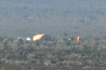 Clean-up crew at F-15C Crash Site |
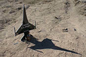 Monument at F-16C Crash Site |
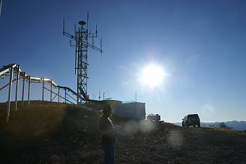
We then pushed onward up highway 93 to the Union Pacific Railroad town called, Caliente. On the nearby 7,500 foot Mt Ella is a radio site for the Nellis Air Combat Training System or NACTS (formerly known as ACMI). During the war game exercises, the participating aircraft transmit GPS location, Altitude, speed, etc. to this system to record every aircraft's movements and actions during the fight. Mt Ella is a major hub for that system. We documented frequencies and the antenna bearings as well as located a smaller remote NACTS site that feeds into Ella. This remote site is called Cedar Ridge. With a little detective work, we found it near "Cedar Range" to the West. It's location was visually confirmed at 37° 38.416'N / 114° 16.007'W
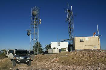 Mt Ella NACTS site |
 |
The next day, we took the HUMMER up to a 9,500 foot mountain called Highland Peak that is even larger than the Mt Ella site to document it's NACTS antennas. When we arrived, we were greeted by several technicians working on the civilian side of the radio installation. After a few minutes, one of the techs approached me while Joerg was poking about. After he left, Joerg asked me if they were kicking us off the mountain. I said, "No, they want me to move the H3 so the helicopter can come pick them up!" Soon after, a black helicopter tail number N530KD, came in for the dust off. I looked at Joerg and said, "A helicopter, why didn't we think of that!" The chopper picked them up and then nosed dived over the side of the mountain disappearing from sight before I knew what was happening. What a ride that must of been! Now we were left all alone to do some serious snooping around! We shot magnetic bearings of all the antennas and noted all the frequencies that we could. The data transmitted on the NACTS system is highly encrypted so knowing the frequencies isn't a threat to national security but it's nice to know the range of the electromagnetic spectrum that the antenna covers. We then confirmed another remote NACTS site about 50 miles North Northeast of Rachel, NV. We will have to visually confirm it's location another day. While I was looking around for the Highland Peak USGS Benchmark, I spotted what appeared to be an old antenna of some sort a little ways down the slope. There was a locked access door that opened just enough to see a garden hose inside it's mast. At the time I absolutely had no idea what this was for. Turns out the new weather station on Tikaboo Peak solved that mystery. It's a percipitation gauge with wind screen.
After heading down the mountain, we went thru the mining town as well as Lincoln County's seat of government Pioche. The town reminded me of the model train platforms my dad put up at Christmas as a kid. We stopped for photos of the old mining equipment and several mine shafts that were blocked off from the public.
Further down the road we stopped for another photo opportunity at Cathedral Gorge. It's looks like another planet and I can't understand why it is not used as a location for major films, etc. You couldn't dream up more unearthly rock formations if you tried. Truly amazing!
So in summary, we located a new crash site and confirmed the second was indeed a F-16 and not something out of Groom. We documented the major NACTS hubs on Mt Ella and Highland Peak. We discovered and visually confirmed the remote site on Cedar Ridge or Range. We confirmed the remote Mormon Mountain site that I stumbled onto in 2008 does in fact point to Mt Ella. Confirmed the existence of another radio site North of Rachel. So I would definitely say our trip was successful and worth the money we spent for food, gas and motel. Then on top of all that we took in some really beautiful scenery around Caliente, Panaca and Pioche. These towns are hidden jewels tucked in a remote area of the great state of Nevada.
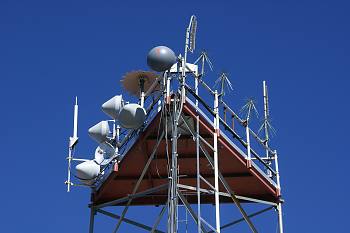 Highland Peak NACTS site |
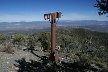 This mysterious device turns out to be a rain gage |
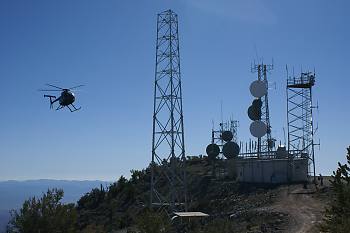 Buzzed by a Black Helicotper... well, sort of... |
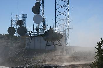 It was picking up a couple of techs servicing the site |
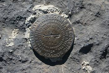 Highland Peak survey marker |
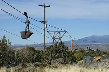 Pioche |
 Highland Peak panorama |