Mormon Radio Facility, August 29, 2009
by Gregos
 Last April I went on a hunt for a F-15c #80-0052 that crashed near the Mormon Mountains on March 25, 2005. While out there I stumbled onto a radio site in the foothills south of Mormon Peak. Rumor had it there was an Air Force - Air Combat Maneuvering Instrumentation (ACMI) system antenna up there as well. This hike has been on my back burner since then...
We left around 11am and headed up I-15 to the Glendale / Moapa Exit. From there you drive north up Meadow Valley Wash Rd along the Union Pacific Rail Road thru the scenic valley. Along the way we hit several water hazards due to the recent rains. Parts of the dirt road leading out to the site were also washed out recently and I wouldn't recommend a trip out there without a good 4WD vehicle with high clearance. The last few miles are thru a few inches of soft sand, so take a shovel too! Once at the site we parked at: 36° 58.400'N / 114° 33.479'W and started the 700 foot climb and around a mile hike to the antenna. The climb was very easy although there is still loose shale, Cholla Cactus and other spiny plants along the way to get cut on. The last few hundred feet after the false summit is fairly rocky. This hill is a half size Tikaboo at about 4400 feet elevation.
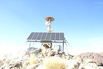
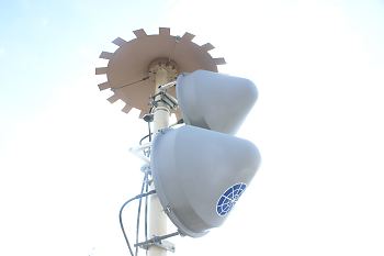
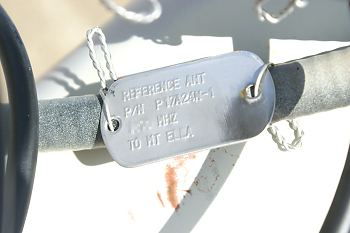
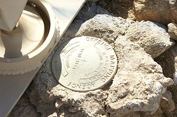
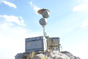
The ACMI antenna is at the summit, at 36° 57.981'N / 114° 33.398'W. The site consists of a transmitter / receiver box about (48" x 30" x 40") with a medium sized solar power panel attached facing south. The solar panel leads to a knack type tool box about the same size as the transmitter / receiver, which I assume has batteries in it as well as it's electrical power components. Attached to the transmitter / receiver box was an eight foot high antenna mast capped by the umbrella shaped - ACMI air to ground antenna. At the base of the mast, is a Defence Mapping Agency Survey Mark [Mormon 11381 -Year 1985]. Directly underneath the ACMI antenna are two identical Comsat RSI wireless dishes pointed at about 345 Deg Magnetic towards Highland Peak. However, upon closer inspection I followed the three cables leading down the antenna mast into the transceiver box. On each cable was a dog tag with the following information from the top antenna down:
AIR ANT
P/N 163881-2
**** MHZ
GRD TO AIR
GROUND ANT
P/N P17A24N-1
****.**** MHZ
TO MT ELLA
REFERENCE ANT
P/N P17A24N-1
**** MHZ
TO MT ELLA
So on the dog tag, it said to Mt Ella (Elly Peak in Google Earth). 155 Deg Magnetic at a distance of 35 miles just south of Caliente, NV. Looking in Google Earth, there appears to be a radio site at the top and possibly a repeater? Maybe to Highland Peak?
The climb down was a breeze and along the way, about a 100 feet below the summit I found a discarded umbella antenna about 4 feet in diameter. It must of blown off in a storm (maybe) and was replaced by the current one. I toted it down the hill as my souvenir! Finders keepers Feds, so don't be kicking down my front door! Lol ;-)
© Copyright 1999-, Dreamland Resort. All rights reserved. Copyright Policy Privacy Policy Page last modified 08/04/2018
 Last April I went on a hunt for a F-15c #80-0052 that crashed near the Mormon Mountains on March 25, 2005. While out there I stumbled onto a radio site in the foothills south of Mormon Peak. Rumor had it there was an Air Force - Air Combat Maneuvering Instrumentation (ACMI) system antenna up there as well. This hike has been on my back burner since then...