 |  |
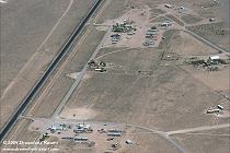
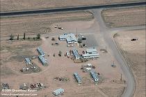
| Downtown Rachel with ET Highway | The Little A'Le'Inn |
 |  |
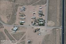
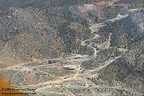
| Quick Pik and Trailer Park | The old Lincoln Mine |
When I first started planning this flight I felt that giving notice to the appropriate sector controllers might keep us from being buzzed by F-15s. I have to stress that the planning efforts had their place. I intended to do this trip with Nellis being well informed and them not needing to check out what our intentions were.
On the evening of May 3, I contacted the Nellis controller for the airspace over Rachel and Alamo area and gave them an outline of our route of flight and purpose for entering that area. The next morning I contacted the sector supervisor and was briefed that several flights of fighter types would be operating in that airspace at approximately 1300 local time. I then had to complete a required ground and flight check with the aircraft rental company. With the check ride completed, and another briefing from Nellis, we departed North Las Vegas airport (VGT) at 1206 local time and were handed off to Nellis departure. Our 1998 Cessna Skyhawk would first climb to 4500' msl till we cleared the high performance departure corridor A-481 that runs from the runways at Nellis to the west-northwest. We were then cleared to 9000' msl as we followed Rt.93 north towards Alamo. The onboard Bendix/King KLN-89B GPS showed the border of the restricted airspace R-4806E as well as our ground speed of 117 kts. Since Tikaboo Peak is 7976' we flew over Alamo and to the north of the peak towards Coyote pass following Rt. 375. Mr. Medlins mailbox and ranch were clearly visible as well as a few of my favorite viewing spots.
The Nellis controller told us she had intermittent radar coverage of us and the military jets in our airspace due to our low altitude. We were told to maintain visual separation with them. When we flew past Tempiute they were cleared into our area. We orbited Rachel at 8500' msl to keep clear of the fighter types cleared below us. Joerg had the better job of observing the sights of Rachel, but we had to keep our eyes out for the Weapons School flights. After contacting Chuck and observing his position, we shot the area while orbiting Rachel. Then we flew around the back side of Tempiute clearly viewing the old Union Carbide mine entrance and hitting a bit of turbulence over the powerlines area but the ride smoothed out heading back towards Tikaboo. We observed a flight of F-16s below us heading north over Apex as we started our decent to VGT airport. We landed at 1433 local time.
I have driven the route to Rachel dozens of times. What struck me at first, flying relatively low over the same route, was how much more there is to the valleys and mountain ranges than what you see from the ground. Obviously this happens every time you fly, but to me the distances are put in a different perspective when you fly this route. This country is vast and beautiful from a few thousand feet agl. It is said that a couple of Lockheed pilots flew over this area in the mid 1950s looking for a remote site to build and test the U-2. They sure picked the right part of the country.
This trip was one of the most memorable flights I have flown and the culmination of ten years of thought and research.
 |  |
| Downtown Rachel with ET Highway | The Little A'Le'Inn |
 |  |
| Quick Pik and Trailer Park | The old Lincoln Mine |