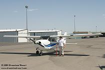

On Tuesday, May 4, 2004 Frank Stamm and I finally took off to a long-planned flight along the perimeter of Area 51 and over Rachel. Frank, an experienced pilot, had spent a lot of time planning the route, including several clearance checks with Nellis Control. Visibility was somewhat limited due to haze, but we decided to go ahead with the mission anyway.
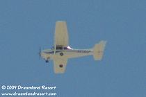
Around noon, after a final clearance check with Nellis Control, we took off from North Las Vegas Airport in a Cessna 172, heading northeast. We flew at 9,000' MSL, up Sally Corridor along Hwy 93 until we reached Alamo. On the way Nellis advised us that several groups of fighter jets were operating in the area, but well clear of our route. When Nellis inquired about the purpose of our flight Frank replied that we were flying a "photo mission 40 miles northwest of Alamo", which seemed to satisfy their curiosity for the moment.
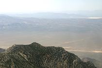
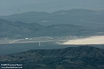
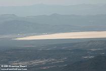
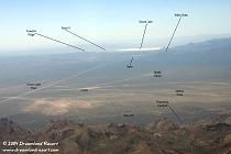
Over Alamo we turned west, crossing the Pahranagat Range just north of Tikaboo Peak. The popular Area 51 view spot looked quite different from the air, but the trail and the viewing area on top were clearly visible. Off in the distance, some 26 miles away, we could see Groom Lake and, at its south end, the infamous Area 51. Visibility was somewhat limited due to the haze, but we could clearly make out several large hangars and the two main runways.
In Tikaboo Valley we had to be careful to avoid the restricted Area 51 airspace, which extends well beyond the restricted area on the ground. To the west we saw the white radar domes on Bald Mountain. Even from this angle we could not get a good look at the low structure in the saddle between the domes. Probably a helicopter landing pad.
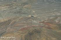
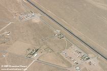
We continued northwest along Hwy 375 and over Timpahute Mountain, with an excellent view of Coyote Summit and the nearby Red Flag view spot. From here we were able to establish radio contact with Chuck Clark on the ground, using a handheld GMRS radio. At 8,500' MSL we flew a wide circle over Rachel, taking photos of "downtown Rachel" and the "suburbs".
At this point there were several Fighter Weapons School flights from Nellis holding over Texas Lake, waiting for us to clear the area. So we headed back towards Alamo, taking a more northern route. On the way we had a great view of the Powerlines Overlook with Tikaboo Valley and Area 51 in the background. After flying back down Sally Corridor we landed in North Las Vegas around 2.30pm.
Even with the limited visibility, the 2 1/2 hour flight was well worth it, seeing Area 51 from different angles, including parts of the base that are obstructed from Tikaboo Peak. And its so much easier than hauling all that gear up the mountain... ;-)
Thanks to Frank for inviting me along for this exciting experience. I hope we can do it again soon in even better viewing conditions.


