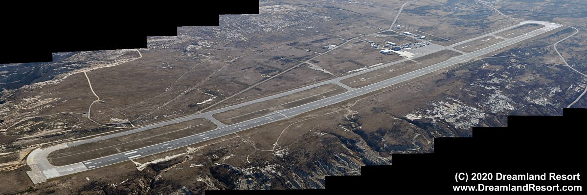
Aerial Photos of San Nicolas Island, July 2, 2020


San Nicolas Island is the most remote of the Channel Islands off the southern California coast, 75 miles south-west of Los Angeles. It is surrounded by 50+ miles of water in all directions. It is controlled by the US Navy and home to the Naval Outlying Field San Nicolas Island. The airfield is used for test and operational evaluation of newly developed aircraft and UAV. The island with its dozens of radar sites on the center plateau also serves as a tracking station for test flights in the Pacific ranges and as a launch site for missile tests. There are two launch sites near sea level at the NW coast of the island.

All photos with friendly permission. Click in the photos to enlarge.

External links for more information:


View of San Nicolas Island from the west. The island is surrounded by 50+ miles of water in all directions and its center is a plateau up to 900 ft. above sea level.

View from the SE, showing a substantial air field on the eastern tip of the island, approximately 500 ft. above sea level.


Naval Outlying Field San Nicolas Island. The runway (12/30) is just over 10,000 ft long; about the same length as the runways of large international airports and almost as long as the massive runway at Area 51. It is easily long enough to accommodate even heavy aircraft.


Close-up of the surprisingly small ramp area. There are only two medium-sized hangars and some associated infrastructure.


Higher angle view of the air field from the east.


Looking down the runway from the north (33° 14.469'N / 119° 27.593'W)

Wind turbines along the south side of the island provide power. The building in the foreground with two antenna rigs next to it looks like an RCS range pointed out to sea, due west (33° 13.890'N / 119° 28.708'W)

Living area on the island, known as Nicktown. The town includes a movie theater, a store, recreation center, barber shop and a bar known as Launch Pad (33° 15.285'N / 119° 29.163'W)

There are literally dozens of radar sites all over the island. It serves as a tracking site for tests in the Pacific Ranges as well as test site for new radar systems.

Communications site at the highest spot of the island with 912 ft. elevation (33° 14.375'N / 119° 30.323'W)

Another radar site, possibly for RCS measurements, pointed roughly SW out to sea (33° 14.713'N / 119° 31.536'W)

Building 807 Tomahawk rocket test launch site. The building is designed to slide on and off the concrete launch pad to conceal the rocket while it is prepared for a test. Judging by the state of disrepair the site has not been used in a while (33° 15.553'N / 119° 34.323'W)


© Copyright 1999-, Dreamland Resort. All rights reserved.   Copyright Policy   Privacy Policy   Page last modified 05/22/2024