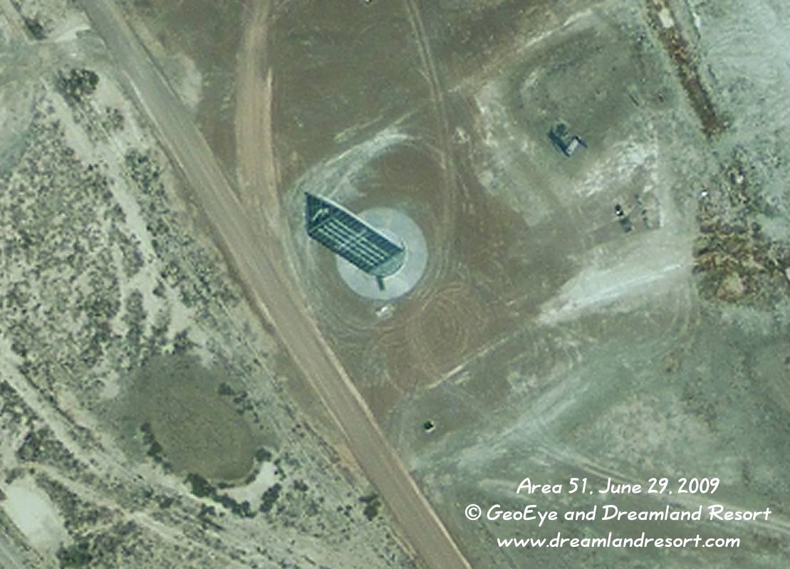
This new tall structure near the RCS range at the north end of Area 51 was built between Sept. 28, 2005 and January 17, 2006. It is triangular in shape, approximately 155 ft. tall and the three sides are about 30 ft. wide. Comparing various satellite images it appears that the tower can rotate around its vertical center axis. There are no support buildings nearby, but the proximity to the RCS rage could suggest that it si controlled from there.
This enhanced version shows some detail of the sides and the top of the tower. It appears to have a round metal base that looks like it may be designed to rotate relative to the surrounding concrete pad. A triangular shape gives the tower the best internal stability. It would be much easier to secure it with guy wires, but if it indeed rotates that would obviously not be an option.
Satellite image taken by the GeoEye-1 satellite on Monday, June 29, 2009 at 11.26am PDT. © 2009 GeoEye and Dreamland Resort. Publication outside of the Dreamland Resort web site is strictly prohibited.