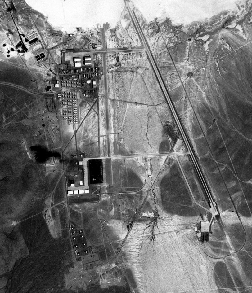
USGS aerial photos of Area 51, taken 8/28/1968
 This USGS aerial photo of Area 51 was taken on 08/28/1968. The hangars at the north end of the base were used for the U-2 program and for the A-12/SR-71 Blackbird. The hangars at the south end were also used for the A-12, and later for the Have Blue/F-117 Stealth Fighter development, which had just started at that time. There are already a few administrative buildings and living quarters in the center of the base.
Notice the B-52 sitting on the north ramp, and a couple of smaller planes, in the south ramp area. The dark spot in the northwest corner of the southern group of hangars is smoke from open-pit burning of toxic waste. Many workers that were exposed to the highly toxic fumes died or became seriously ill later. The toxic waste burning continued until the early 1990's, when a lawsuit by former workers brought it to public attention.
Click here or in the image for a 1 Meter super high-resolution clip of the main base. With friendly permission by Steve Hauser.
© Copyright 1999-, Dreamland Resort. All rights reserved. Copyright Policy Privacy Policy Page last modified 08/04/2018

