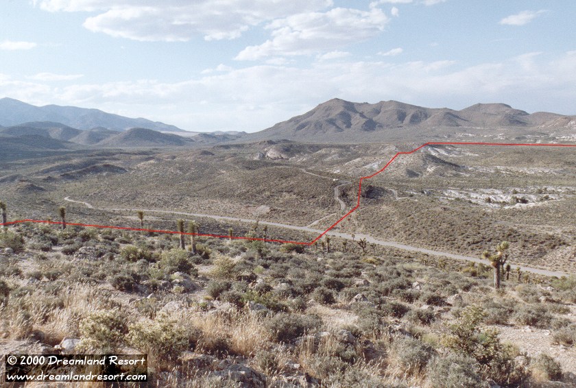
 The other cammo lookout hill. The orange line roughly marks the border. The signs are where the line crosses Groom Lake Road. The land to the left of the red line is the restricted area. Use extreme caution when hiking in this area. Off the road, the border is marked only by orange posts, spaced about 50 yards apart. The border runs straight north here, and then turns east to include White Sides Mountain. As you can see the road up to the lookout hill forms a loop, which at both ends intersects with Groom Lake Road inside the restricted area. On the left side of this photo Groom Lake Road turns left, and leads south around a hill to the hidden Guard Shack. The cammos usually drive up in the back of the hill and park on top, facing the boundary. When they leave their lookout they drive down the side of the hill facing the border, coming very close to the boundary. |