There is some confusion about the legality of flying drones around Area 51. This article tries to clarify a few points as the author understands them as of this writing in 10/2018. It is by no means intended to be legal advice. Fly your drone at your own risk. It is your responsibility to fully understand the law.
Most of the public land surrounding Area 51 is what drone manufacturer DJI calls an "Enhanced Warning Zone". From the DJI web site: In these Zones, you will be prompted by GEO at the time of flight to unlock the zone using the same steps as in an Authorization Zone, but you do not require a verified account or an internet connection at the time of your flight. Example Enhanced Warning Zone: A farm which is 3 miles away from a busy international airport. For more information see this map.
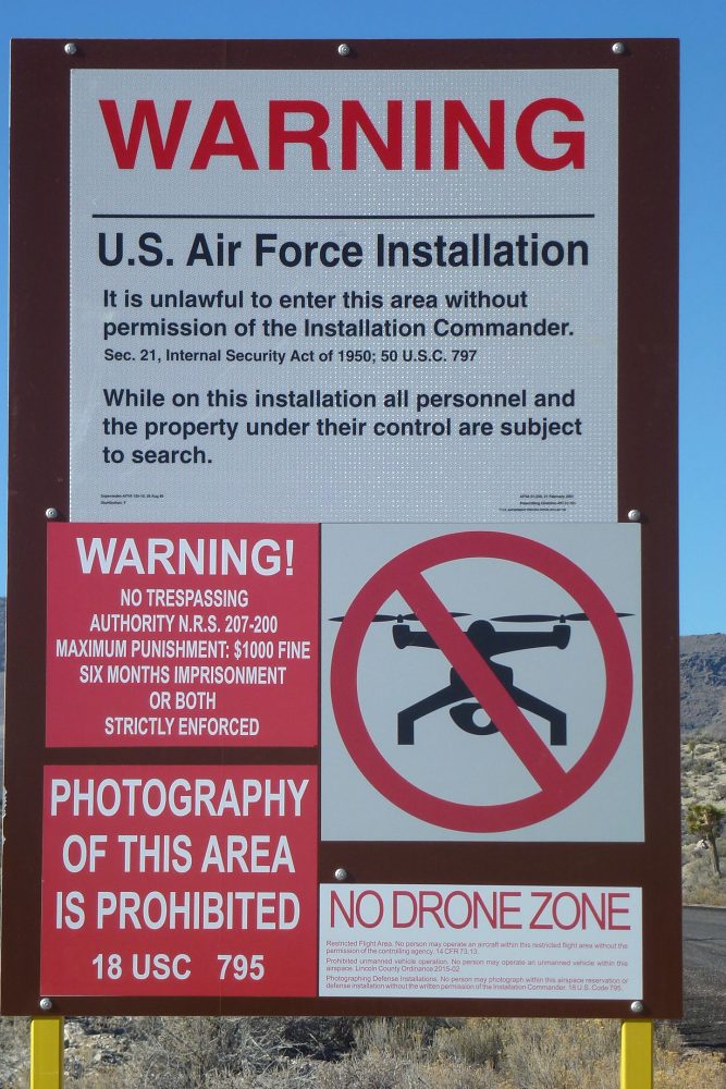
The Lincoln County Drone Ordinance, approved in the Commissioner's meeting on Sept. 8, 2015 states: Whereas the rapid implementation of unmanned aircraft technology throughout the United States poses a serious threat to privacy of the residents and citizens of Lincoln County, as well as to entities and government agencies operating in Lincoln County; and able to gain unprecedented access to private and government property, the ability to unreasonably interfere with and prevent real property owners and users from the legitimate use and enjoyment of their real property; photograph and record, and otherwise capture images and sounds of property, activities, and persons without consent; and signs along the perimeter of the Nevada Test and Training Range already warn that photography of the test site and training range is prohibited pursuant to 18 U.S.C § 795.
Our interpretation of what all this means is the following. Again, it is our interpretation, which may or may not be correct:
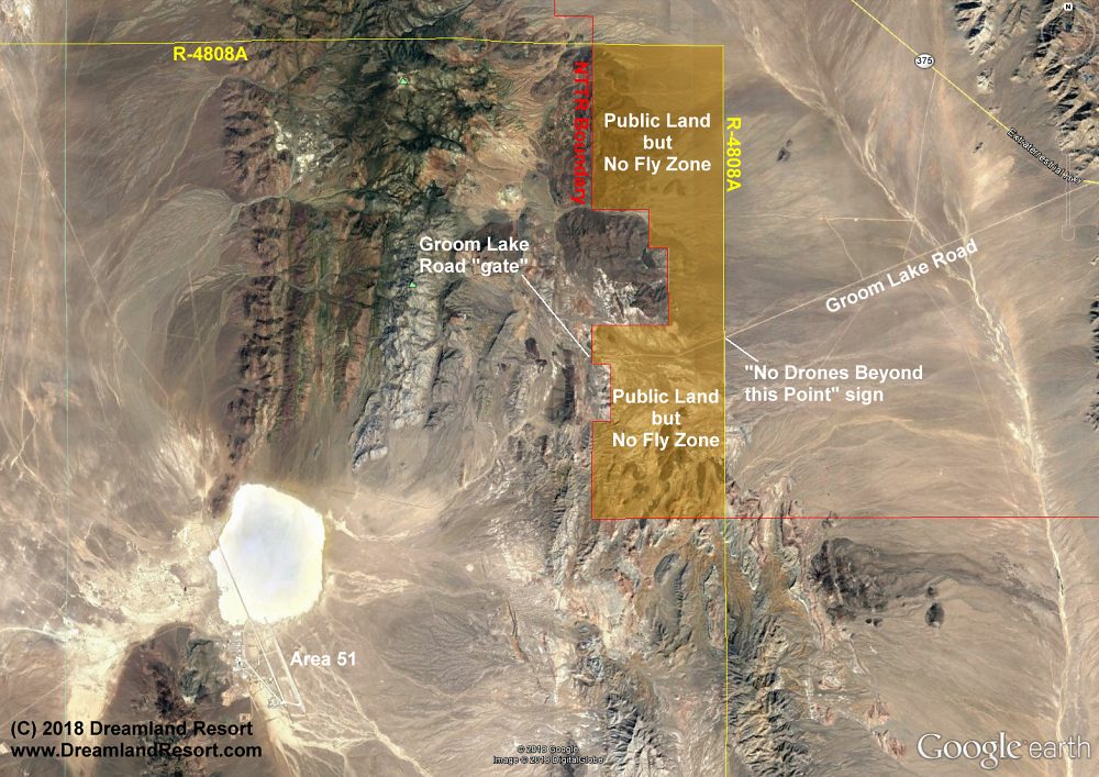
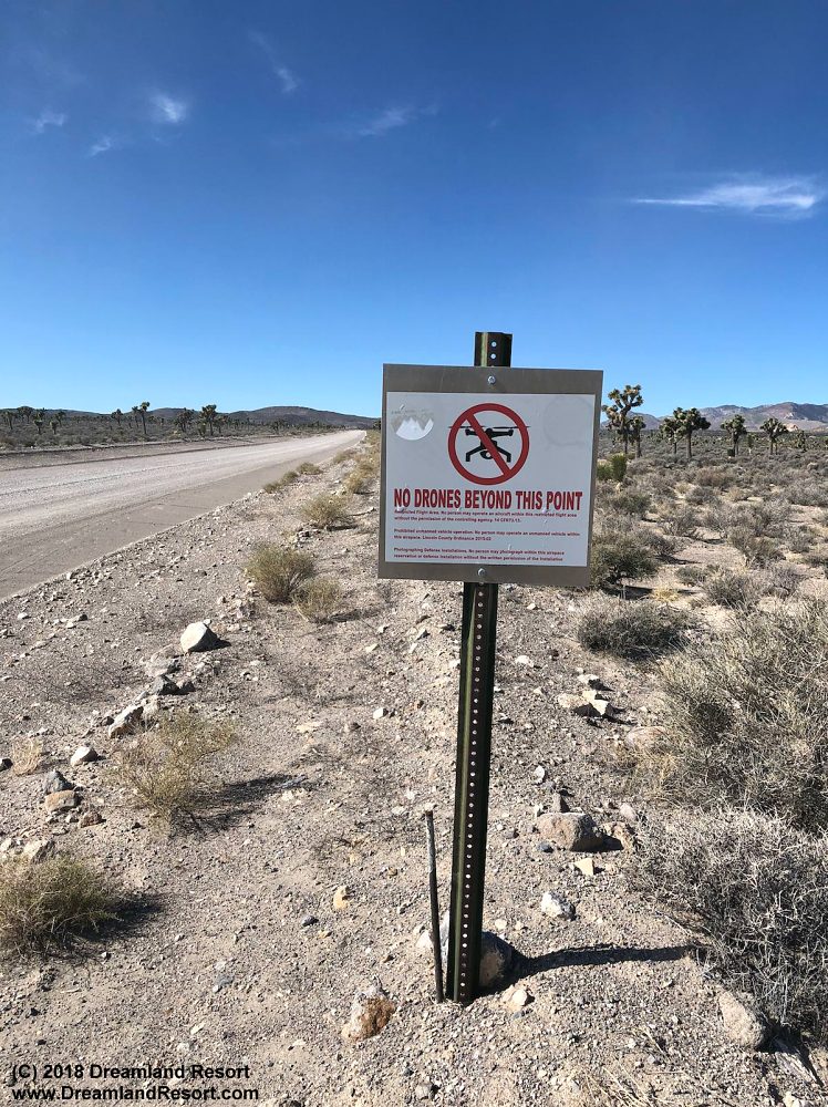
The Google Earth screen shot below shows the overlapping no-fly zones. The NTTR Boundary is marked in RED, the R-4008A airspace is marked in YELLOW. Notice how the R-4808A airspace extends a few miles up Groom Lake Road onto public land (shaded in ORANGE). In this area it is illegal to fly a drone. The boundary of this air space has recently been marked with a sign on the ground along Groom Lake Road. There are also "No Drone Zone" signs on all major "gates" leading into Area 51.
In early 2018 the Air Force requested an amendment to the Lincoln County Drone Ordinance that would have extended the no-fly zone another two miles outside the existing perimeter as described above. In the Jan. 16, 2018 Commissioner's meeting we opposed that amendment. After we presented our case the Commissioners agreed that the existing no-fly zone, as defined in the 2015 ordinance, is sufficient. The Air Force request was not approved. See the Lincoln County Record web site for more information.
It is up to us drone pilots to prove that the current no-fly zone is sufficient by adhering to the existing ordinance. As tempting as it is, taking photos or video of Area 51 from a drone, and especially publishing the material online will result in an extension of the no-fly zone. Quite possibly making all of Tikaboo Valley and Sand Spring Valley off limits to drones. Let's not give the Air Force reason to consider that.
All that said, enjoy flying your drone when you visit. There are many interesting places to explore. For some cool drone videos see our YouTube channel showing places of interest around Area 51 and Rachel. And check out the Nearby Places section of our Rachel, Nevada web site.
Update 06/2023: This article focuses on flying drones around the Groom Lake Road Gate of Area 51. At the Back Gate (or Rachel Gate) a similar situation exists. The "No Fly" zone extends east outside the gate for 1.1 miles following the road. That is where the R-4807A airspace ends and the Desert MOA airspace begins, where (according to our current understanding!) it should be legal to fly drones with certain restrictions. Please see the NTTR Boundaries Google Earth plugin for reference. No guarantees, use at your own risk.


