Hi-Res Aerial Panoramas of Area 51, July 4, 2020
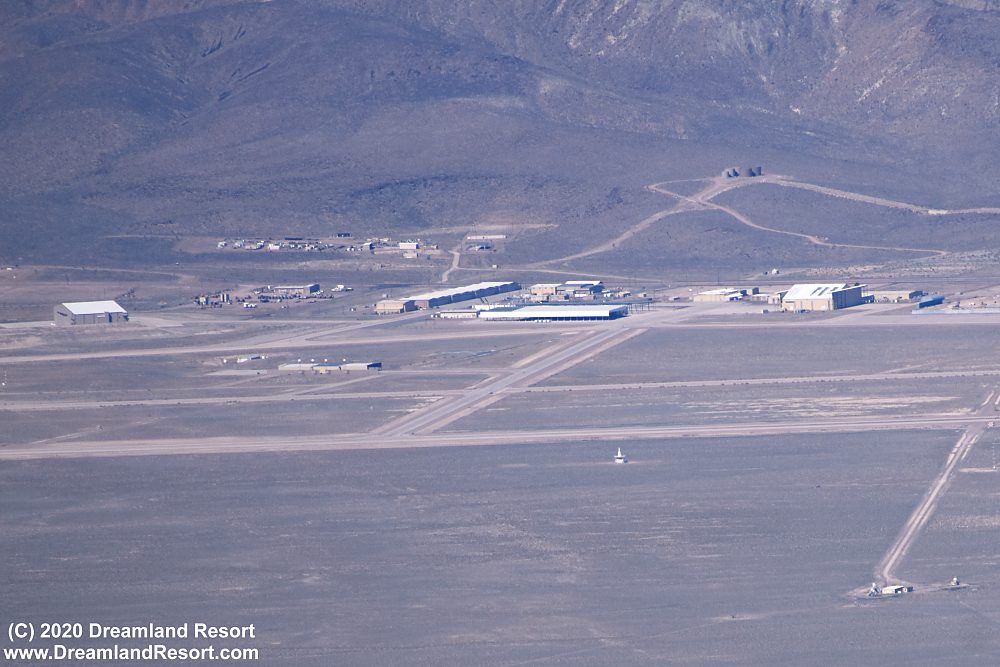
The photos below were taken from a private aircraft operating in legal airspace flying along the northern boundary of Range 61 towards Area 51. The pilot took some incredible high resolution photos of the base. The photos were taken from a similar direction as photos from Tikaboo Peak, but from a higher angle (approx. 10,000ft) and closer distance.
The photos reveal more construction at Area 51. As reported in April 2020 a new huge scoot-and-hide type hangar is being built just east of Hangars 20-23. This hangar, with open sides, is nearly finished now as you can see below. The photos also reveal a similar hangar being built on the west side of the hangars. The newly constructed shelters are designed to conceal aircraft on the ramp in front of the four hangars. Each of the shelters measures approximately 500x150ft. Together with Hangars 20-23 they cover an area of almost 5 acres.
Another change since April is that the large hangar just SW of hangars 20-23, built in 2009, is being demolished (#62 in our Area 51 Building Map). That hangar had sustained severe roof damage a while ago and was never repaired. The original purpose of the hangar and the cause of the roof damage is still unknown.
Also, the lot just south of the new dining hall, west of the Janet ramp, is being developed for new construction.
Photos taken 07/04/2020. Publication on Dreamland Resort with friendly permission from the pilot. Click in the photos to enlarge.

Wide angle panorama showing Area 51, Groom Lake and much of Emigrant Valley. The road in the foreground that leads around the north end of Groom Lake is Groom Lake Road, coming from the Groom Lake Road gate. It continues in the background to Gate 700 and via the Nevada National Security Site (NNSS) and Mercury Highway ultimately to Hwy 95 near Mercury.

Hi-res panorama of the main base area.

Close-up of the construction at the Area 51 south ramp. The hangar east of hangars 20-23 is nearly finished. On the west (far) side of the hangars the steel skeleton of a similar scoot-and-hide in an earlier stage of construction can be seen. The top part of the "2009 hangar" behind and to the left of the new construction is gone and some construction equipment can be seen in that area.

Contrast enhanced close-up of the new construction. It appears the western shelter will extend further to the south than the one on the east side of H20-23. This may be the reason the "2009 Hangar" is being demolished or modified.

It looks like the previously vacant lot just south of what is believed to be the new dining hall is being developed for new construction. There is clearly some earth moving going on and the screen that separates that lot from the Janet ramp has been extended further south.
Related Links:
Raw photos from the flight including Mercury, Desert Rock, Nellis AFB, Texas Lake, Area 51, Papoose Lake, Rogers Peak in Death Valley and Star Wars Canyon
© Copyright 1999-, Dreamland Resort. All rights reserved. Copyright Policy Privacy Policy Page last modified 05/21/2024


