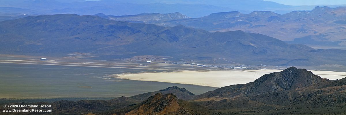
Aerial Panoramas of Area 51 from different angles, May 24, 2020
Below are four panoramas of Area 51 from different angles, taken from a private aircraft skirting the perimeter of the restricted area in legal airspace at approximately 11,000ft. Publication on Dreamland Resort with friendly permission by the pilot and photographer. Click in the panoramas for a super-sized version.

Area 51 from the north-east. The angle is similar to Tikaboo Peak but from higher altitude, revealing some of the facilities in the valley east of the base that are hidden from view from Tikaboo. The massive new scoot-and-hide hangar in front (east) of hangar 20-23, which was first discovered in the April aerial photos, now has a 1/2 height side wall on the side facing us, similar to the extensions of hangar 19. It is clearly designed to keep whatever project will move into hangars 20-23 out of sight while it is readied for flight. Since the new addition covers all four hangars it can be assumed that the new project will be several fighter-sized aircraft, quite possibly autonomous UAVs. With a size of 150x500ft. each (or a total 3.5 acre footprint) the new canopies are easily the largest single structure at Area 51.

Area 51 seen from an angle similar to the old Freedom Ridge view spot. The road in the foreground is Groom Lake Road coming from the Hwy 375 side with the GL Rd. guard shack just out of frame at the bottom. On the far site of the dry lakebed Groom Lake Road continues to Gate 700 and into the NNSS.

Area 51 seen from the NNE. The new canopy in front of hangars 20-23 is clearly visible in the center.

Area 51 seen from the NNW from an angle similar to the very distant Reveille Peak view spot. The road in the foreground leads from Area 51 to the Back Gate near Rachel. The new (left) and old (right) runways are clearly visible.

Bonus 1: This is what Area 51 looks like from roughly the direction of Rachel. This angle clearly shows how massive the new 2007 and 2014 hangars are.

Bonus 2: Area 51 seen from a location near the Back Gate. Again the dominant features are the huge 2007 and 2014 hangars. The 2007 hangar dwarfs hangar 18 in front of it, which until 2007 was the largest hangar at Area 51.

Bonus 3: Papoose Lake seen from the north. No sign of Lazar's hidden UFO hangars or any other infrastructure. In the foreground is the landfill south of Groom Lake Road, a few miles west of Area 51.
Related Links:
Raw photos from the flight including Creech AFB, Area 51, Rachel, R-4807A and China Lake
© Copyright 1999-, Dreamland Resort. All rights reserved. Copyright Policy Privacy Policy Page last modified 05/21/2024


