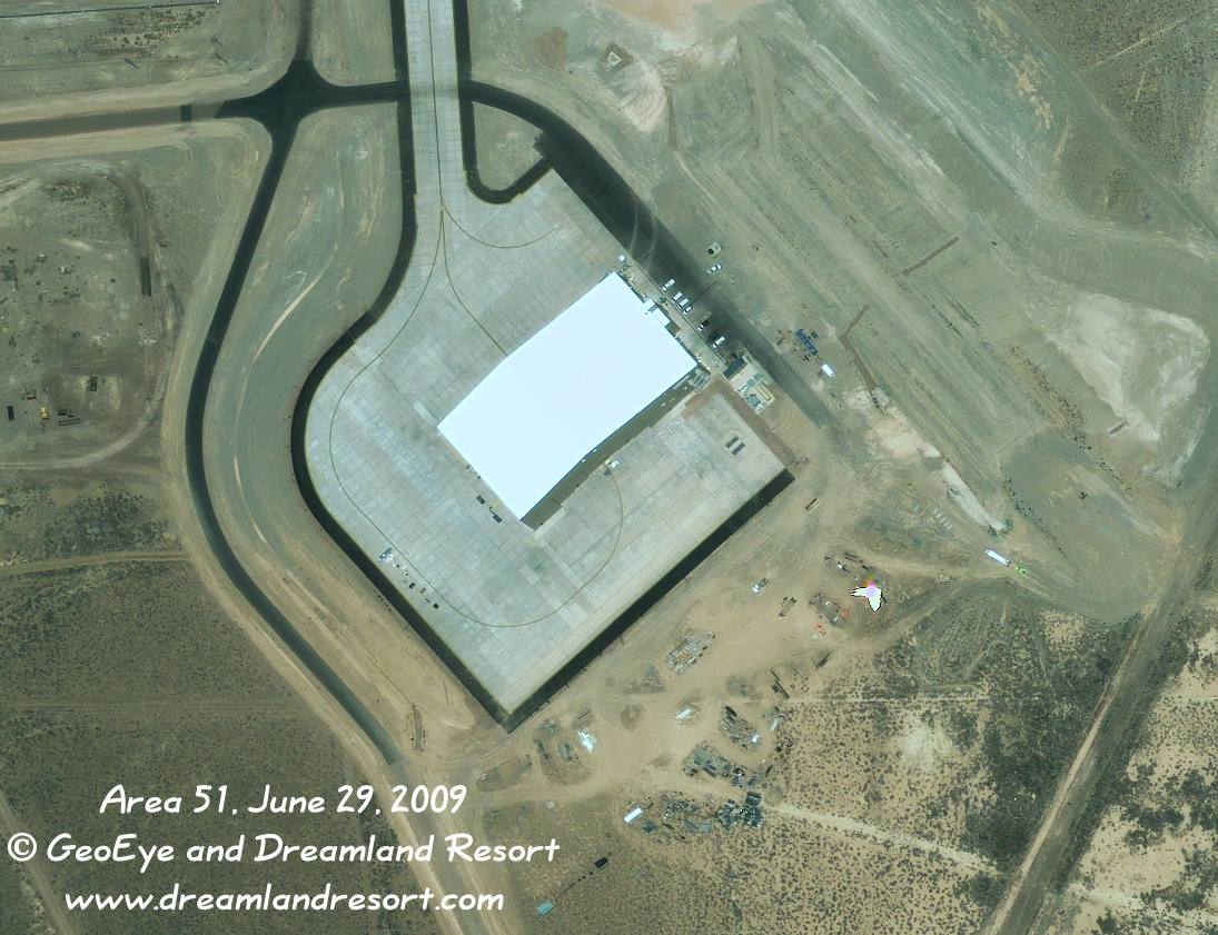
This first-ever published 0.5 meter resolution close-up of the new hangar shows a large surrounding ramp area with a connection to the flightline to the north. The taxi markings on the ramp suggest that the hangar houses one large aircraft that sits in its center, instead of several smaller aircraft, like UAVs. The southern hangar doors are visible in this shot. There is an access road and parking on the north-east side of the building, as well as air conditioning ducts, emergency exit stairs etc. All this suggests that that side of the hangar houses related offices. Looking at the stairs in the east corner, there appear to be five or six floors of offices. The berm, which blocks the view of most of the hangar from Tikaboo, is still on place and appears un-changed since our 2007 satellite image.
Satellite image taken by the GeoEye-1 satellite on Monday, June 29, 2009 at 11.26am PDT. © 2009 GeoEye and Dreamland Resort. Publication outside of the Dreamland Resort web site is strictly prohibited.